GPS Route for Cycling in Cyprus
Use a GPS route for easy trail finding when cycling in Cyprus. Hire a Garmin Edge GPS with routes pre-loaded so you don't waste time trying to find the best bike trails
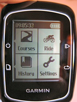 Garmin Edge 200 GPS
There are hundreds of fantastic mountain bike trails here in Cyprus, but as map detail is poor (the best you can get in the Paphos area is 1:100,000), route finding can be tricky, not least as many trails are not even shown on a map.
So using a GPS route is the ideal way to go right? Well yes, but only if you have ridden the routes already and have them pre-loaded into your GPS unit.
If you're short on time or would like to hire a guide, but can't justify the cost, then there's a perfect solution - hire a GPS unit for the day pre-loaded with courses to make route finding super easy.
Cyprus GPS Bike Routes
 GPS route map
Local bike and hike specialist Wheelie Cyprus are now offering Garmin GPS units for hire along with their quality bike hire service.
They also provide written notes and a Google route map extract showing the trail for orientation purposes. All you do is switch on the GPS unit, choose the relevant course and pedal away, following the arrow on the screen. If you veer off course, the unit beeps at you, so you can't go wrong.
Tip: Don't know how to use a GPS? Don't worry, Wheelie Cyprus explain everything in full, give you notes on how the GPS unit operates and are always at the end of a mobile phone if you need help.
GPS Route Planning
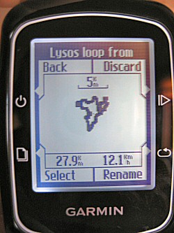 GPS route in Cyprus
The new Garmin Edge 200 GPS unit is easy to use. Courses are pre-loaded and once you choose a route, the screen will show you the "course" profile, as seen in the opposite image.
It fits neatly onto the stem of the bike and once ready, you press start and an arrow appears along with the next few hundred metres of the course. Simply follow the arrow and turn left/right when the unit tells you to.
You can stop at any time for a drink or some snacks, then just press restart to continue your ride.
No more wondering which way to go when you reach a junction with 3 different options to choose from! Plus imagine how much time you'll save - rather than burying your head in a map trying to figure out the best Cyprus trail to follow, you get more quality bike riding time :)
Google Maps and Routes
Using Google maps in conjunction with a Garmin GPS makes planning routes much easier, but some people may be concerned about their fitness level as Cyprus is pretty hilly in places.
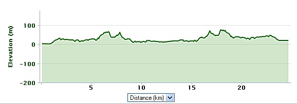
Tip: Worried about how much climbing is involved? Just look at the elevation profile provided with your route guide notes.
 Elevation profile
Route notes tell you the total amount of height gained and lost so you have a clear idea, in conjunction with the the elevation profile above just how hard the ride may be.
In the above example, while the maximum elevation is never more than 100m, the total height gain on this route is just over 300m, as there is a fair bit of up and down involved. But the profile shows that any uphill sections are short, rather than one long climb uphill slog.
So next time you want to ride some bike trails in Cyprus, why not consider hiring a GPS to make GPS route finding easy?
Kali Pothilato!Related Pages:
Favourite Things to Do







New! Comments
Have your say about what you just read! Leave me a comment in the box below.